Services Offered

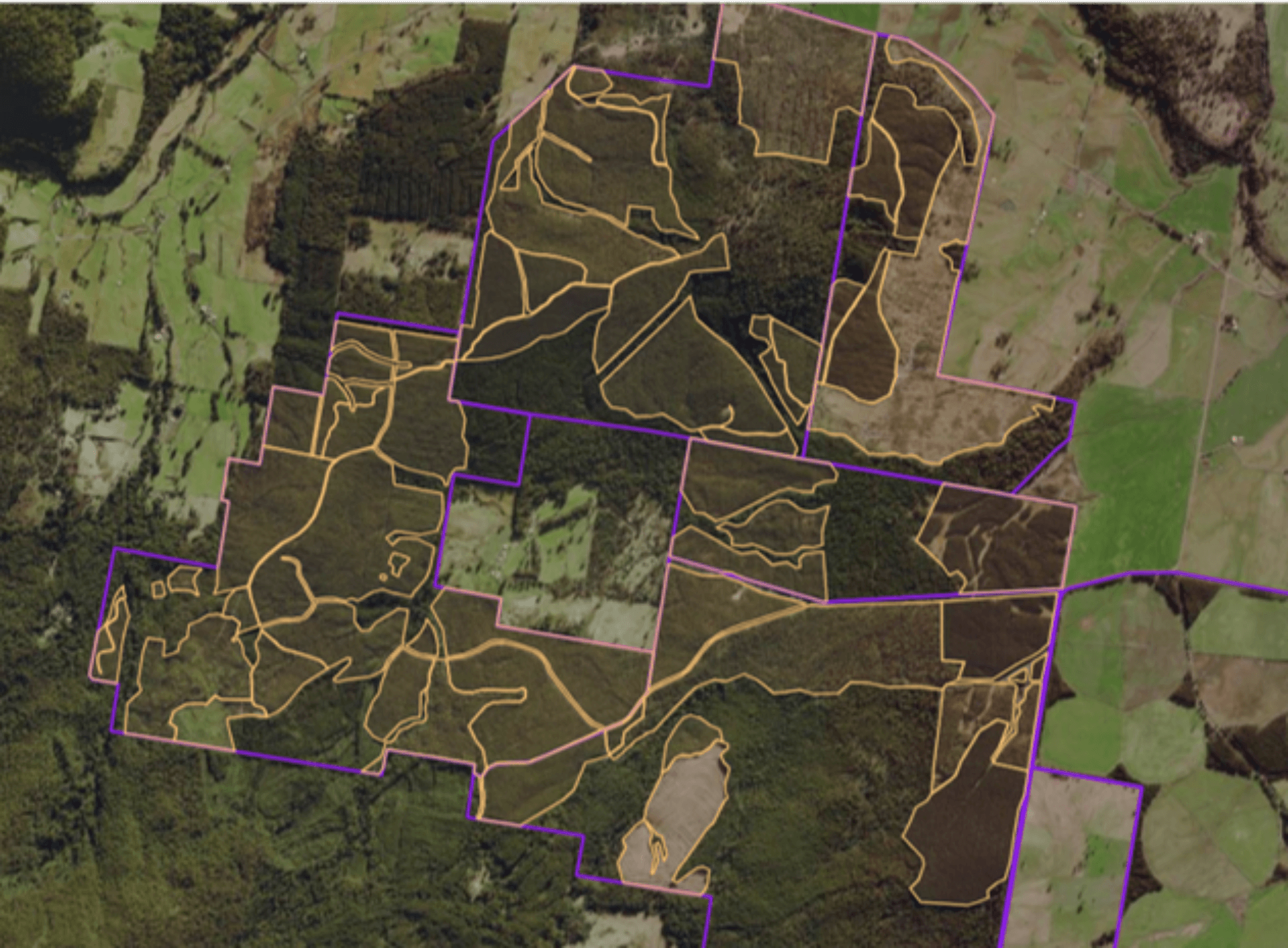
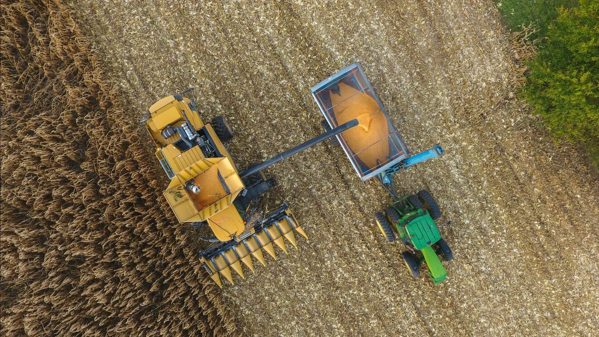
Forest, Fire and Cartage Modelling​

Data-driven insights for smarter, sustainable forest management. Effective forestry management relies on accurate data and predictive modelling. Our forestry modelling solutions have dealt with greenfield plantation capability and suitability mapping, fire behaviour modelling  and forestry road infrastructure network optimisation across Australia, empowering clients to make data-driven decisions for sustainable forest investment and management.​ We provide inventory design and analysis, yield table and growth model development, and physiological-based modelling, helping clients assess forest productivity and optimise resource allocation. We specialise inAPSIM [...]

2025-09-08T10:56:28+10:30

Carbon Project Support​

Optimising carbon outcomes with precision modelling and expert guidance.​ Navigating the complexities of ACCU Scheme projects requires precise data, regulatory expertise, and strategic insights. Our Carbon Project Support services help organisations assess, manage, and optimise their carbon initiatives, ensuring compliance while maximising environmental and financial benefits.​ We specialise in FullCAM modelling, offset reporting pre-checks, regional carbon modelling, and audit preparation - critical components in developing and managing carbon offset projects. Whether supporting plantation forestry methods, verifying carbon sequestration potential, or [...]

2025-09-08T10:56:46+10:30

Forest Acquisition, Sale and Valuation Support​

Minimising risk, maximising value for forest asset investment and divestment​ Investing in forest assets demands thorough analysis and strategic foresight. Our acquisition due diligence services provide investors, landowners, and forestry managers with comprehensive assessments that reduce risk and inform better investment decisions.​ Using tools such as TigerMoth and Woodstock software, we conduct strategic forest estate modelling, stand area and mapping audits, and property-level financial modelling, delivering a clear picture of asset viability and performance potential. Our web-based mapping solutions offer [...]

2025-09-08T10:59:42+10:30

Planning & Development​

Smart spatial solutions for sustainable urban and regional planning​ Effective planning and development require accurate spatial intelligence. We empower governments, planners, and developers with high-quality mapping, risk assessments, and spatial analysis to drive well-informed decisions that balance growth, sustainability, and resilience.​Our expertise spans planning scheme maps, flood modelling, bushfire risk analysis, significant tree mapping, and open space planning. We help councils and developers comply with regulatory requirements while optimising land use, mitigating risks, and enhancing community outcomes.​​Through GIS-powered insights, scenario [...]

2025-09-08T11:02:28+10:30

Asset Management​

Reliable data for better infrastructure and asset decisions.​ Infrastructure and asset management rely on accurate, well-structured spatial data. We help councils, utilities, and government agencies manage and maintain critical assets through advanced data preparation,GIS applications, and mobile solutions.​ Our services include spatial data validation for asset integration, custom-built Field Maps applications, and end-to-end asset inspection services. Whether preparing road network data for council systems or enabling field teams with mobile GIS tools, we ensure seamless, efficient asset workflows.​​ By leveraging [...]

2025-09-08T11:04:01+10:30

Technology and Strategic Advisory​

Empowering organisations with smarter geospatial strategies and technology.​ Digital transformation is reshaping how organisations leverage geospatial technology. Our Technology & Strategic Advisory services help clients plan, implement, and optimise their GIS ecosystems for long-term success.​We specialise in enterprise GIS implementation, system upgrades, data migration, and business continuity planning. From transitioning to ArcGIS Online to modernising ESRI Enterprise deployments, we provide expert guidance and execution to ensure a seamless transition.​Beyond technology, we offer strategic advisory for business planning, capability assessments, and [...]

2025-09-08T11:06:48+10:30

Remote Sensing​

Unlocking deeper insights through aerial and satellite data.​ Remote sensing is revolutionising how industries monitor, assess, and manage landscapes. Our advanced aerial, drone, and satellite imaging solutions provide high-precision data for forestry, government, and environmental applications.​ We specialise in annual aerial acquisition, UAV surveys, 3D terrain mapping, and imagery analysis. Our services support applications from forest health monitoring to volumetric reporting and environmental change detection.​ By leveraging remote sensing, we help clients reduce field costs, improve monitoring accuracy, and gain [...]

2025-09-08T11:08:09+10:30

Precision Agriculture​

Innovative geospatial tools for smarter farming decisions. Agriculture thrives on precision, and our geospatial solutions help farmers and agribusinesses optimise land use, improve yields, and ensure environmental sustainability.​ Our seed isolation system enables growers to coordinate planting locations in a confidential and secure online platform, preventing cross-pollination and ensuring genetic purity whilst ensuring no sensitive growing locations are shared between potential competitors. We also provide chemical inventory management systems, helping agribusinesses track and optimise chemical use.​ With advanced GIS, remote [...]

2025-09-08T11:09:35+10:30

Emergency Services​

Geospatial intelligence for disaster preparedness and response.​ When emergencies strike, real-time geospatial data is critical for rapid response and risk mitigation. We provide spatial solutions that support emergency services, natural hazard management, and disaster planning.​Our expertise includes bushfire risk assessment and modelling, emergency mapping, emergency weather and incident alert systems, and operational GIS tools:​We developed the Portable Access Weather Station (PAWS) Viewer which is used by the Parks and Wildlife services across ACT, NSW and TAS, delivering to fire controllers [...]

2025-09-08T13:22:32+10:30
Go to Top